Central Highlands, Ben Alder Routes 2, 4 or 6 Munros Circuit from Dalwhinnie

Central Highlands, Ben Alder 6 Munros Circuit from Dalwhinnie
Scotland
🚲 Bike and Hike: ✅
🏕️ Camp: lots of areas to camp
💧 Water: river running through valley
🏊 Cold Water: river and lochin
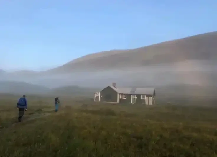
🏡 Bothy: Ben Alder Bothy Culra
Route Description:
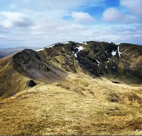
From Dalwhinnie, follow estate tracks and moorland paths southwest toward the base of Ben Alder. Ascend steep slopes to reach the first Munro of the circuit, then continue along connecting ridges to tackle the remaining five summits in a clockwise loop, including peaks such as An Socach and Beinn Bheoil. The terrain is a mix of open moorland, steep grassy slopes, and rocky ridges. The route offers expansive views across Loch Ericht, Loch Laggan, and surrounding Highland mountains. Return to Dalwhinnie by retracing the final ridge and following estate tracks back to the village.
34 miles, 9 hours - 2 days, 6 Munros
(Munro) Carn Dearg 1034 meters
Lat, Long 56.854921, -4.454983
OS Grid Ref NN504764
(Munro) Geal-charn 1132 meters
Lat, Long 56.837626, -4.511237
OS Grid Ref NN469746
(Munro) Aonach Beag 1118 meters
Lat, Long 56.832741, -4.530583
OS Grid Ref NN457741
(Munro) Beinn Eibhinn 1102 meters
Lat, Long 56.825295, -4.543194
OS Grid Ref NN449733
(Munro) Ben Alder 1148 meters
Lat, Long 56.813377, -4.465373
OS Grid Ref NN496718
(Munro) Beinn Bheoil 1019 meters
Lat, Long 56.813121, -4.432586
OS Grid Ref NN516717
34 miles, 9 hours - 2 days, 6 Munros
bog***
hike**
no deer stalking
Aonach Beag: Four Munros from Dalwhinnie
(Munro) Carn Dearg 1034 meters
Lat, Long 56.854921, -4.454983
OS Grid Ref NN504764
(Munro) Geal-charn 1132 meters
Lat, Long 56.837626, -4.511237
OS Grid Ref NN469746
(Munro) Aonach Beag 1118 meters
Lat, Long 56.832741, -4.530583
OS Grid Ref NN457741
(Munro) Beinn Eibhinn 1102 meters
Lat, Long 56.825295, -4.543194
OS Grid Ref NN449733
26 miles hike car park start, 8 hours - 2 days, 4 Munros
bog***
hike****
Ben Alder and Beinn Bheòil from Dalwhinnie
Scotland
(Munro) Ben Alder 1148 meters
Lat, Long 56.813377, -4.465373
OS Grid Ref NN496718
(Munro) Beinn Bheoil 1019 meters
Lat, Long 56.813121, -4.432586
OS Grid Ref NN516717
11 miles, 7-8 hours, 2 Munros
bog***
hike**
no deer stalking
Submit Walkers Report
Mountain, Scottish, hill, munrobagging, munro weather, munro parking, distance, time.